
A dust storm followed by a thunderstorm, with light rain or drizzle and lightning, is very likely to occur in Delhi, bringing respite from the scorching heat, the India Meteorological Department predicted on Tuesday.
 (RAJ K RAJ /HT PHOTO)")
Gusty winds of 30–40 kmph are expected across several areas, including Narela, Bawana, Alipur, Kanjhawala, Rohini, Badli, Pitampura, Mundka, Paschim Vihar, Punjabi Bagh, Rajouri Garden, Jafarpur, Najafgarh, Dwarka, Palam, and IGI Airport, along with Bahadurgarh in NCR, the weather body said.
Similar conditions are expected in the next two hours in parts of Haryana, including Hansi, Meham, Sonipat, Tosham, Rohtak, Kharkhoda, Bhiwani, Charkhi Dadri, Matanhail, and Jhajjar.
These reports are as of 3.40 pm on Tuesday.
The India Meteorological Department said isolated to scattered light to moderate rainfall with thunderstorms, lightning and gusty winds (30–40 kmph) is likely over Punjab, Haryana, Chandigarh and Delhi during April 28–30 and May 2–4.
Similar activity is expected over West Uttar Pradesh from April 28–30, East Uttar Pradesh from April 29–May 1, West Rajasthan on April 28–29 and May 2–4, and East Rajasthan between April 28 and May 4.
Also Read | Rain respite likely in Delhi today as mercury soars to 42.3°C, 3.3°C above normal
More on weather in Delhi today; what to expect
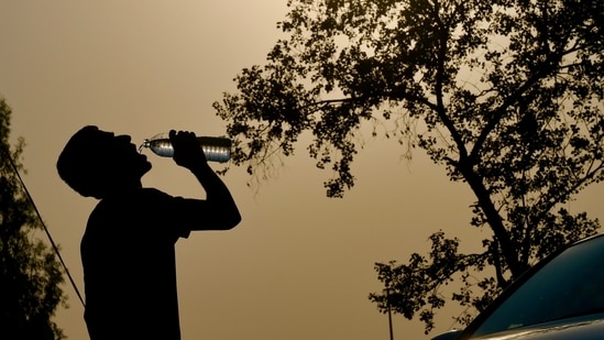
Delhi baked under above-normal temperatures on Monday, with the mercury rising up to 4°C above average across stations, though IMD stopped short of declaring a heatwave and signalled a marginal dip with light rain from Tuesday.
Safdarjung, the city’s base station, recorded a maximum of 42.3°C, 3.3°C above normal, while the Ridge station in north Delhi touched 43.8°C, 4.3°C above average. Despite the spike, no station met the heatwave criteria, similar to Sunday.
However, conditions shifted by evening as a dust storm swept across the capital between 8 pm and 9 pm. Around 7 pm, IMD issued an alert warning of gusty winds and possible light rain, though no rainfall was recorded till late Monday. An IMD official said wind speeds peaked at 61 km/hour at Pragati Maidan, followed by 54 km/hour at Pusa.
IMD has forecast partly cloudy skies on Tuesday, with the possibility of drizzle in isolated areas. A yellow alert has been issued for Wednesday, with one to two spells of light rain and gusty winds of up to 50 km/hour expected, likely bringing the maximum temperature below 40°C.
“Temperatures are likely to dip from Tuesday, with chances of drizzle to very light rain on Tuesday and light rain on Wednesday. The maximum should return close to normal and even below normal by Thursday,” an IMD official said.
Also Read | Rain, storms to bring Delhi respite from heatwave soon. Here’s what IMD said
Cooling trend to continue on Tuesday
Officials said the cooling trend is expected to continue till Thursday, with daytime temperatures likely between 39°C and 41°C till at least May 3. The city had recorded heatwave conditions for three consecutive days between Thursday and Saturday.
While isolated heatwave conditions were observed on Thursday and Friday, a citywide heatwave was declared on Saturday – the hottest day of the year so far – when the Ridge station recorded 44.5°C and Safdarjung touched 42.8°C.
Mahesh Palawat, vice-president at Skymet Weather, said the expected rain is due to a cyclonic circulation over central Pakistan and adjoining northwest Rajasthan.